A field record of projects we delivered — not stock photography
From geodetic survey and land subdivision to setting out towers, façades and industrial trusses — every card below is a real, delivered project.
Bab Al-Sham — land survey & subdivision
Survey and subdivision of a 45-dunam site using Differential GPS to guarantee coordinate accuracy, set out alignments, and divide the land in line with the urban master plan.
Al-Adhamiya Hotel — survey supervision
Full survey supervision for a 2,500 m², 12-storey hotel, setting out from foundation level to the upper floors with total stations.
Al-Atifiya — large-scale structure
Survey works for a 22,000 m², 3-storey structure, monitored from foundation excavation through to final finishes to guarantee alignment and full verticality.
Al-Jadriya Mall — façade setting-out
Precision setting-out of the mall façades — work demanding high accuracy to reconcile complex architectural design with site reality.
Al-Musayyib Steel Plant — façade area computation
High-accuracy façade area computation using total stations, for costing, quantities and finishes.
Large-span steel truss — survey & setting-out
Survey and setting-out of foundations and steelwork for a large-span truss (40 m face × 90 m span), with base and anchor-bolt levelling held to millimetre accuracy.
Iraqia University Master Plan Update
Integration of field work and digital analysis: digital survey of every university building with GPS, remote-sensing analysis, and a geospatial database classifying land use to support management and maintenance.
Al-Adhaim City master plan
Preparing and updating the city master plan: field projection of spatial data via GPS, planning on updated aerial imagery, and zoning of residential, commercial, industrial, green and road-network land uses.
German Hospital — façade survey & setting-out
High-accuracy survey and setting-out of the hospital façade to ensure construction matched the approved design.
Our GIS Work
Actual outputs from our projects in spatial database construction, analysis and cartographic production — from work inside ArcGIS Pro through to the final approved map.
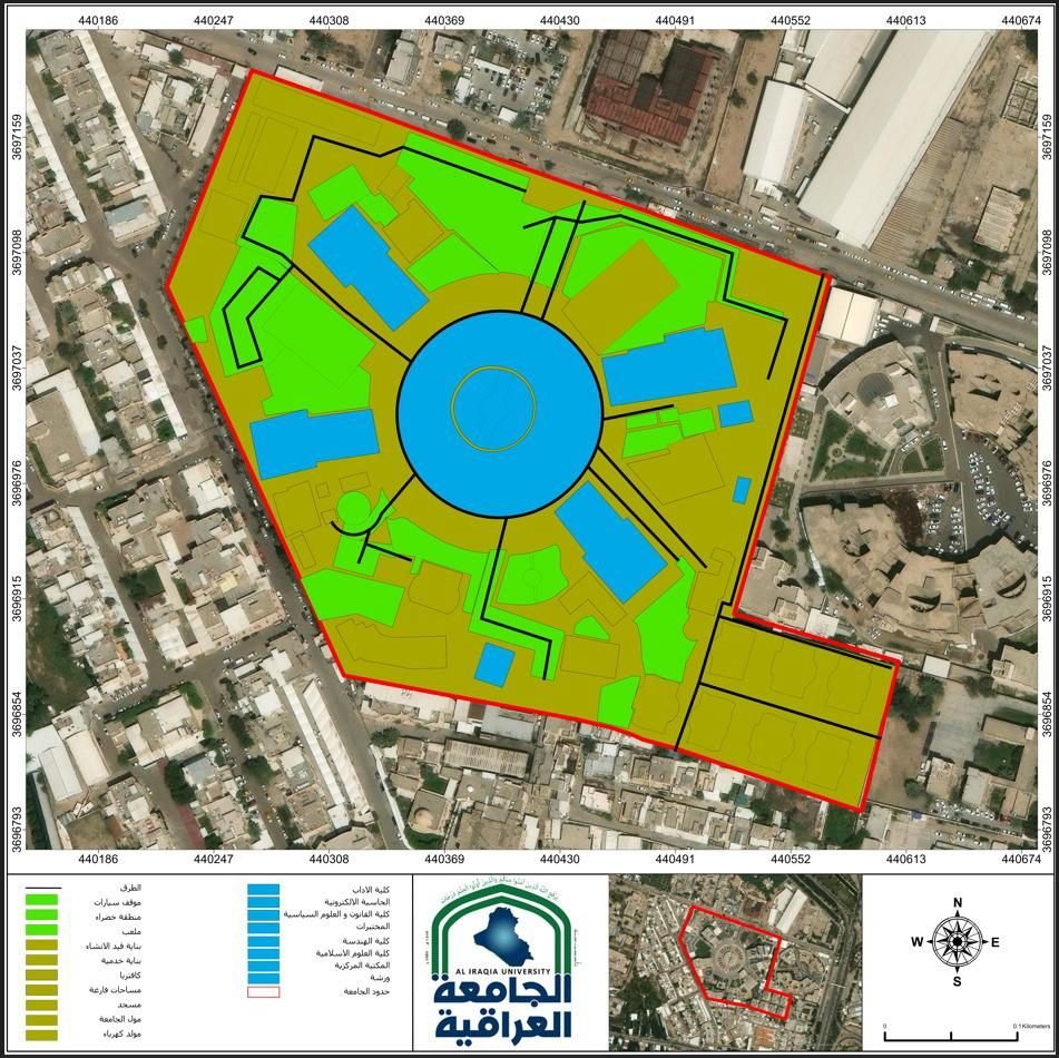
Al-Iraqia University — Full Land-Use Classification
A complete classification map combining every layer of the plan: faculties, service buildings, green areas, parking and vacant land within the campus boundary.
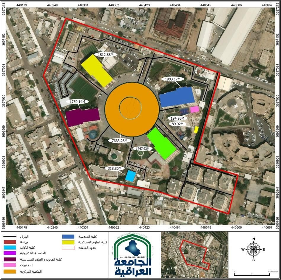
Al-Iraqia University — Faculties and Areas
Distribution of the faculties, central library and laboratories with each building's area in square metres, plus a full map legend with scale bar and north arrow.
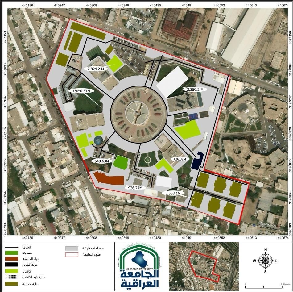
Al-Iraqia University — Service Buildings
Classification of the mosque, mall, generators, cafeteria, buildings under construction and vacant land, with a calculated area for each.
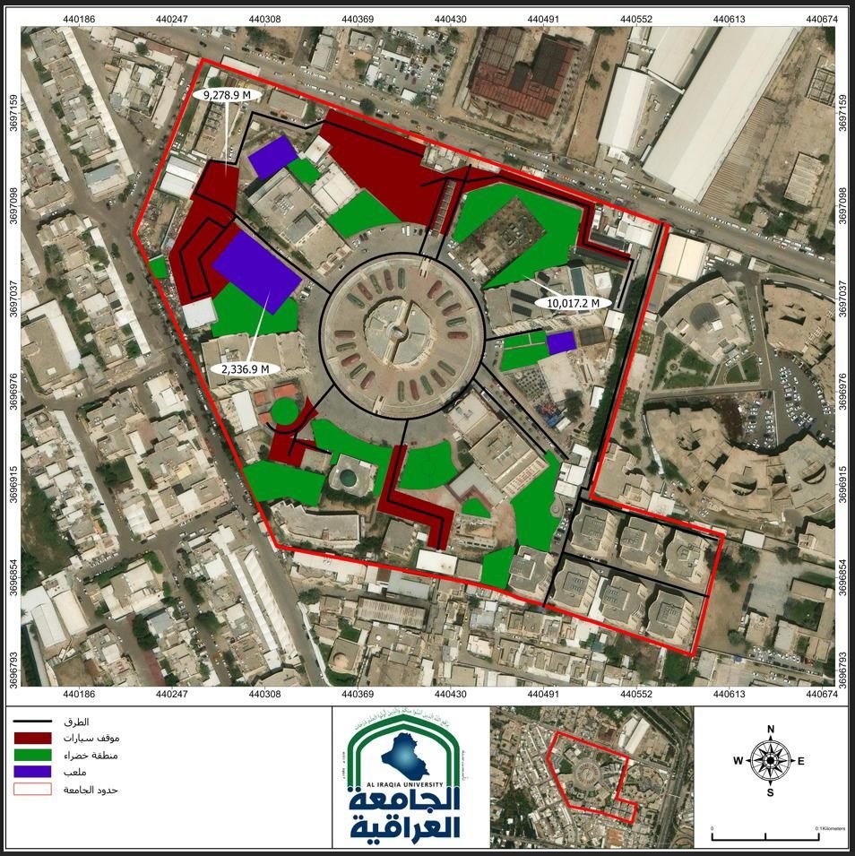
Al-Iraqia University — Green Areas and Parking
Mapping the car parks, green areas and sports grounds across the campus with their areas.
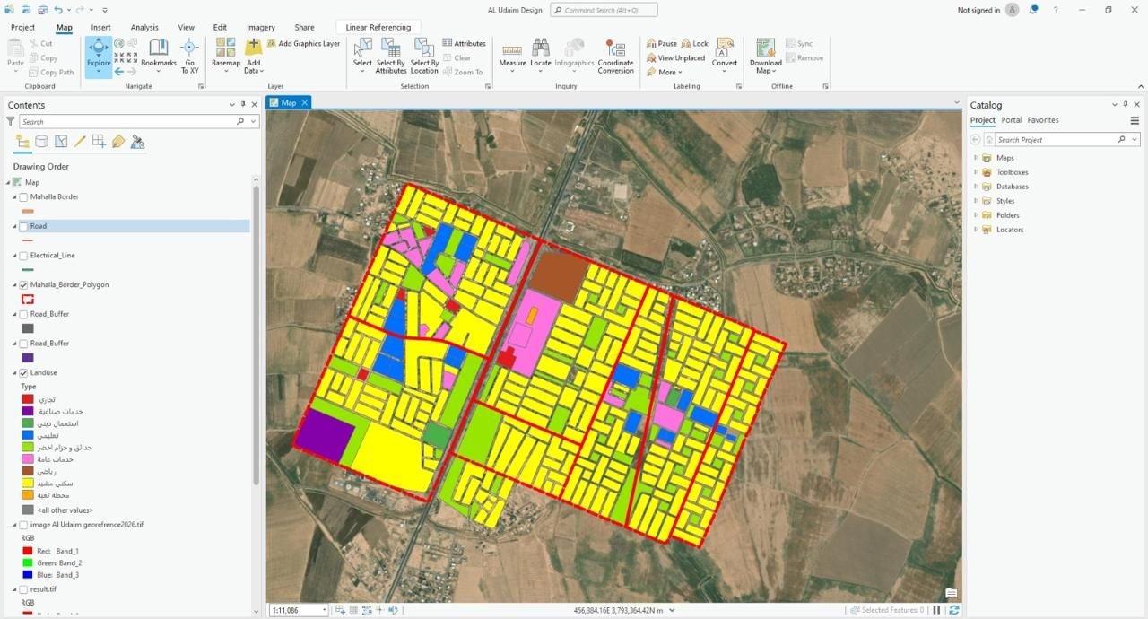
Al-Adhaim — Building the Land-Use Layers
The ArcGIS Pro workspace while building the land-use layer: residential, commercial, educational, religious, sports, public and industrial services, parks and green belt — over georeferenced satellite imagery.
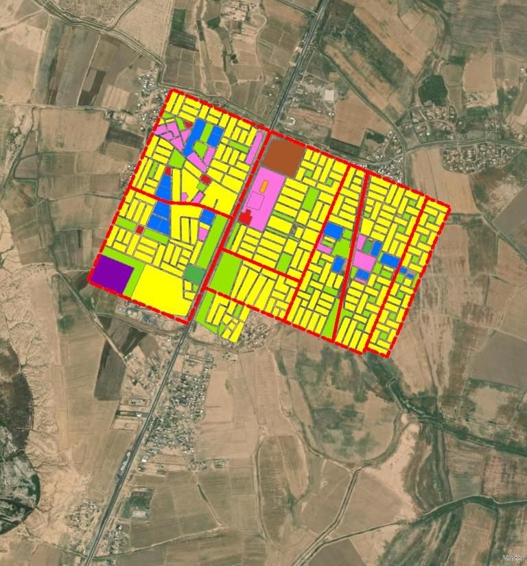
Al-Adhaim — Final Master Plan
The final output classifying land-use zones, the road network and residential quarter boundaries.
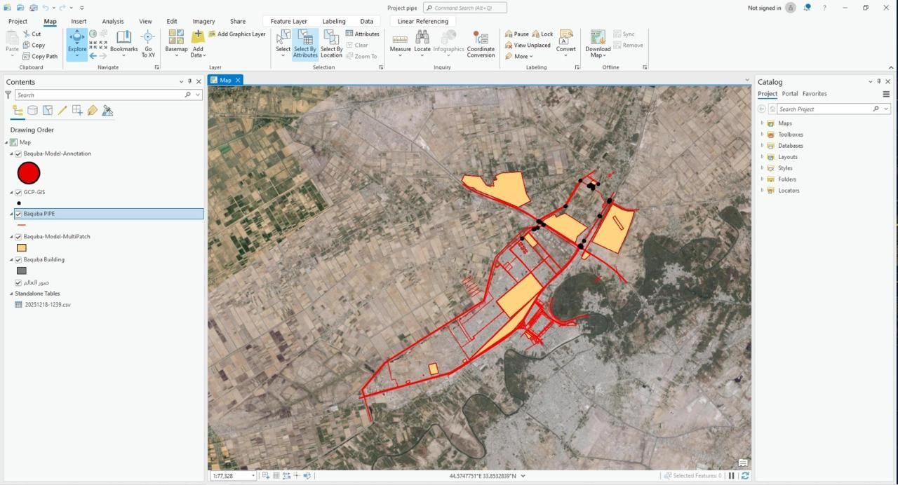
Baquba — Pipe Network Modelling
Building a pipe-network model in ArcGIS Pro with building layers, ground control points (GCP) and a 3D model, over satellite imagery.
Partners & Clients
We are proud of the trust placed in us by Iraq's leading contractors and engineering consultancies: Qimat Al-Mimariyoun · Kayan · Ozone · Eng. Salwan Al-Ta'i Office · Al-Bu'd Al-Mimari.
Your next project deserves the same precision
Send us the site details and we will come back with a clear plan of work.